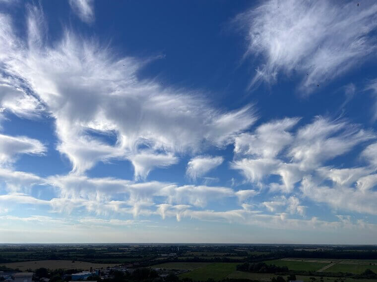
Cirrus: High Wisps, Change Inbound
High, delicate cirrus are the sky’s warning postcards: thin, hairlike streaks called “mares’ tails.” Hovering near 20,000–40,000 feet (6–12 km), they’re ice‑crystal streamers sculpted by the jet stream or anvil blow‑off from distant storms. Cirrus seldom produces precipitation, but it advertises change within 24–48 hours as a front approaches. Sailors long relied on them, and cloud‑namer Luke Howard formalized the term in 1802. When those wisps parade across a blue dome, savor the view and expect lower, thicker clouds to follow soon. Often in bands before a warm front, photographers love silky sunsets.
Cirrostratus: Halo Makers, Rain On Deck
Cirrostratus is the high, milky veil that turns the sun or moon hazy and creates halos. Spread between about 20,000 and 40,000 feet (6–12 km), it forms when broad, gentle uplift fans ice crystals thinly across the sky. A crisp 22° halo is the classic “storm approaching” signal, because this sheet often precedes warm fronts by 12–24 hours. Light still filters through, so the Sun becomes a smudged coin rather than vanishing. If this gauzy canopy expands steadily, plan on rain or snow later, and perhaps a photogenic ring before the weather arrives.

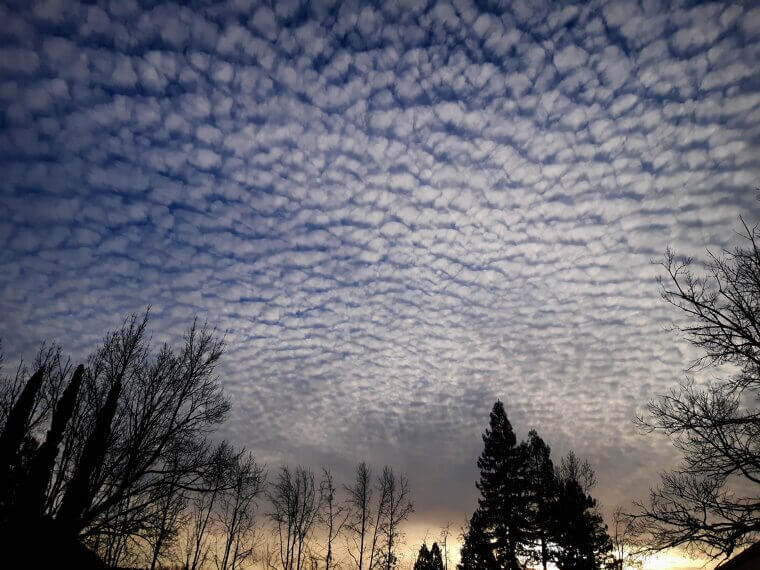
Cirrocumulus: Mackerel Sky, Pattern Shift
Cirrocumulus paints a classic “mackerel sky” with tiny ripples and rows that resemble fish scales scattered across blue. High and delicate at roughly 18,000–35,000 feet (5.5–11 km), these puffs arise from small‑scale convection in icy, dry layers, often downstream of jet‑stream disturbances. They rarely produce precipitation at the ground, but they telegraph instability aloft and a pattern shift within a day. An old mariner’s rhyme warns, “Mackerel sky, not twenty‑four hours dry.” See those tidy textures marching overhead? Expect evolving cloud decks next, and keep travel plans flexible if fronts or waves are nearby.
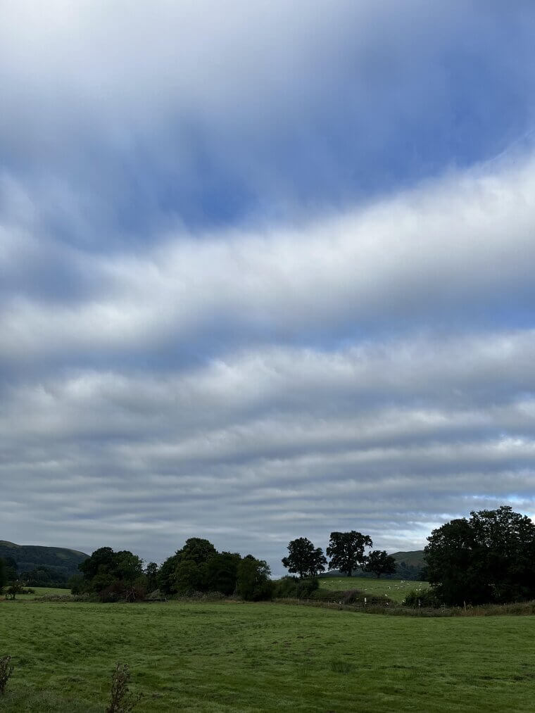
Altostratus: Watery Sun, Steady Precip Ahead
Altostratus is the “watery sun” cloud: a broad gray or bluish sheet that turns the sun into a blurred disk. Clouds living in the mid-levels, around 6,500–20,000 feet (2–6 km), form when warm, moist air glides up and over cooler air, lifting steadily over a wide area. That gentle but persistent ascent wrings out hours of light to moderate rain or snow, with little thunder or drama. Think of it as the curtain‑raiser for a well‑organized frontal system. When altostratus spreads and thickens, outdoor plans need backup, and umbrellas appreciate the invitation.
Altocumulus: Puffy Plaques, Afternoon Trouble
Altocumulus shows up as gray‑white plaques with gentle shading, sometimes sprouting castle‑like turrets called castellanus. Anchored at mid-levels—roughly 6,500–20,000 feet (2–6 km), these patches grow from pockets of convection above a stable layer. On summer mornings, a telltale sign is the castellanus: the atmosphere is primed for afternoon showers or thunderstorms if the heating continues. Pilots expect a bumpier ride beneath these fields; hikers feel a friskier breeze. When altocumulus multiplies and deepens, expect towering cumulus next. If the plaques flatten and drift, the day often stays simply textured and dry. Photographers love the layered texture.

Stratus: Low Blanket, Drizzle Mood
Stratus is the sky’s low gray blanket, a featureless deck that erases hills and mutes horizons. Hugging the surface to roughly 6,500 feet, it favors cool mornings when moist air sits trapped beneath a temperature inversion or drifts ashore as a marine layer. Expect murky visibility, mist, and drizzle rather than dramatic downpours. Stratus forms with gentle lift, not thunderous updrafts, so the day feels quiet, damp, and a little yawny. On coasts, “June Gloom” is the poster child: stratus rules breakfast, then thins toward lunch if sunshine pokes through.

Stratocumulus: Sunbreaks, Not Storms
Stratocumulus is the classic “gray but okay” sky: lumpy, low rolls separated by blue gaps. Usually between 1,500 and 6,500 feet, it builds when turbulence churns moist air beneath an inversion, organizing puffs into cells. The weather stays settled chiefly, with a stray sprinkle at worst and occasional sunbreaks that spark neighborhood optimism. After a cold front, stratocumulus often lingers like the encore before clear air arrives. Pilots expect bumps; photographers grab texture. If the deck thickens and closes, watch for drizzle. If it thins, you may earn an afternoon glow.

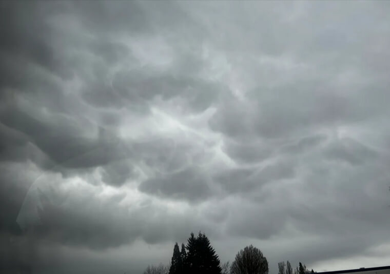
Nimbostratus: All‑Day Soaker
Nimbostratus is the all-day soaker, a thick, dark sheet that erases the Sun and hangs ragged along the base. It spans low to mid levels and forms when a broad, sustained uplift in a frontal system squeezes moisture steadily, hour after hour. Expect continuous rain or snow, minimal thunder, and a soundtrack of windshield wipers. Visibility slumps, moods follow, but reservoirs cheer. The name is literally Latin: nimbus for rain, stratus for layer. When this ceiling settles in, plan slow travel, comfortable shoes, and recipes that reward a long simmer.
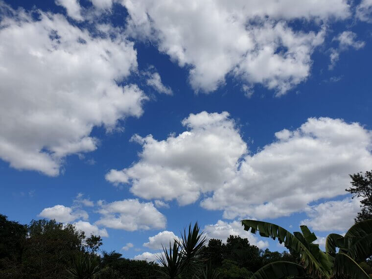
Cumulus Humilis: Fair‑Weather Cotton
Cumulus humilis is fair-weather cotton, small, flat-based puffs that bloom by late morning and fade near sunset. Bases often sit between about one and six thousand feet, where gentle surface heating lofts moist air until a stable cap says “that’s high enough.” Showers are unlikely; shadows are welcome. These clouds serve as mood rings for the boundary layer; when they are tidy and shallow, it indicates that the atmosphere is content. If they start stacking taller and darker, plans may need to be adjusted later. Otherwise, they’re picnic green lights, doodling across blue like friendly cartoons.
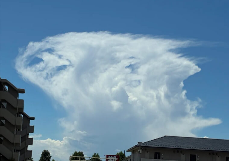
Cumulus Congestus: Towers In Training
Cumulus congestus is towering in training; cauliflower stacks with crisp edges racing skyward. Bases start low, but vigorous updrafts keep feeding moisture, building vertical mileage in minutes. If the tops of the mountains begin to glaciate, turning fibrous and white, it indicates that thunderstorms are near. Expect showers soon, and possibly small hail if growth continues. Pilots watch them like traffic; hikers watch them like clocks. Congestus is the busy workshop where fair weather becomes action. When shadows darken and gusts freshen, secure plans and scan radars. Those lively turrets can mature quickly into lightning and downpour.
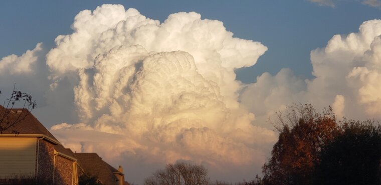
Cumulonimbus: Anvils, Thunder, Action
Cumulonimbus is the showstopper: massive towers crowned with anvils, powered by roaring updrafts and plunging downdrafts. It spans from low bases to the tropopause, sometimes punching higher with an overshooting dome. The weather typically consists oflightning, deluges, gust fronts, hail, and sharp temperature drops. Shelf clouds and mammatus hint at turbulent outflows. Underneath, visibility vanishes, and thunder owns the soundtrack. Formation demands deep moisture, instability, and a trigger like a front or dryline. Respect the core, watch for warnings, and remember storms are short stories written quickly, often dramatically and loudly.
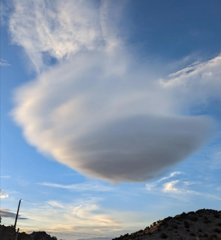
Lenticular (Altocumulus Lenticularis): Mountain UFOs
Lenticular clouds are the mountain range’s calling cards, smooth lens shapes stacked like pancakes that hover near ridges. They form when strong winds flow over terrain and the air oscillates in standing waves; moisture condenses at the crests and evaporates in the troughs, freezing the cloud in place. Altitudes vary from mid to high, but rain is not guaranteed. Glider pilots chase the lift; photographers chase the UFO vibe. When lenticulars sharpen and multiply, assume vigorous winds aloft and potential mountain wave turbulence, even under otherwise sunny blue skies overhead.