A Colorful Storm
From the outside, this multi-colored storm cloud looks hauntingly beautiful. But normally, the more impressive and beautiful the weather phenomena are, the more powerful and dangerous they can really be. And when this storm chaser spotted this cloud formation in Califorania 2020, they knew that it was something special. From the different colors to the twisting and turning shapes, this was indeed something to keep a safe distance away from.
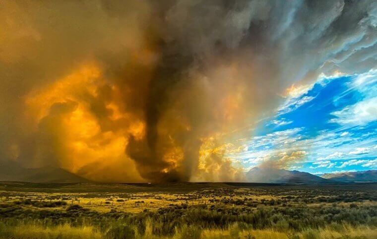
Apparently, this was a rare formation that ended up being a fire tornado. Yes, that's a combination of a deadly tornado and fire. And those who live in tornado alley will know that this is the ultimate sign to get back inside.
A Starry, Stormy Night
Most of us are used to looking up at the night sky and seeing the stars, but this photo is unlike anything we have ever seen. At first glance, you probably noted the stunning starry sky, filled with constellations, galaxies, and billions of stars blinking back at you. But at second glance, you probably noticed the extreme weather in the photo's background. And it looks like a stormy night.
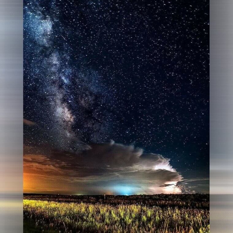
This condensed cloud formation is a sure sign of extreme weather. Somewhere towards the back of the corn field was a storm brewing, and it looked like it would be a big one.
A Supercell in Kansas
In terms of meteorology, a supercell is a buildup of updraught and downdraught, which ultimately results in extreme weather like epic thunderstorms, tornadoes, and golf-ball-sized hail. In fact, it's these supercells that storm chasers follow in the hopes of getting inside the eye of the storm. This weather phenomenon can normally be spotted before it forms, as the supercells look like a strange collection of clouds - very similar to this one.
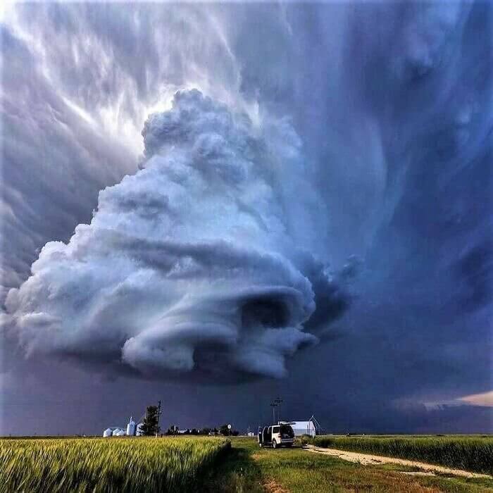
This supercell was spotted near Leoti in Kansas, which might not come as a surprise to those who live in Kansas. After all, Missouri is constantly battling with extreme weather and wild weather phenomena.
A Thunderstorm From Above
When most people see a thunderstorm from below, they know what's coming. They know that they're going to be hit with extreme weather, and sometimes, all they can do is wait out the storm and wait for it to pass. But this photo shows us what a thunderstorm looks like from above, and we have a pilot to thank for giving us this new perspective. In fact, this picture shows a thunderstorm from high up above inside an airplane.
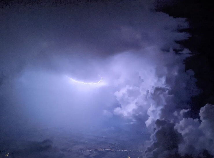
While being up in the air often makes the world feel small, this extreme weather photo proves just how powerful thunderstorms can be. What's more, people on the ground had no idea how big this thunderstorm really was.
A Storm Forming Over Wisconsin
Anyone familiar with Wisconsin or nearby areas will know that this state is used to dealing with extreme weather. On a daily basis, this state is battered with tornadoes, supercells, thunderstorms, hailstones, and so much more - and this picture sums that up perfectly. And while the bottom of this photo with the adorable red barn and the long grass in the fields looks incredibly wholesome, the top is anything but.
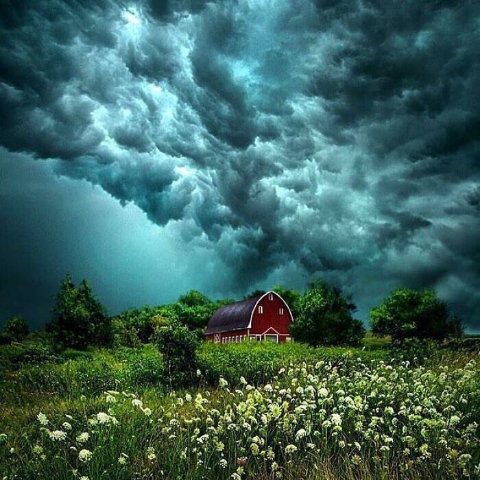
This storm formation goes to show just how powerful this weather phenomenon can be. Within seconds the clouds can twists and turn, forming into bigger storms that can dwarf the landscape below.
A Stormy Sunset in North Carolina
At first glance, this extraordinary photo looks as though it could be the result of Photoshop gone wrong. It looks like two different photos awkwardly merged together, but this is actually a picture of a stormy sunset over Wild Horses Beach in North Carolina. And while the combinations of colors, supercells, and beach landscapes make this photo look absolutely breathtaking, it's important to realize that this can be incredibly dangerous.
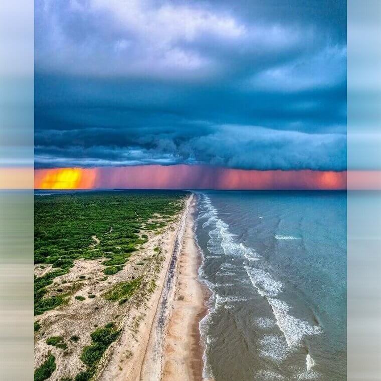
If you were to spot a scene like this while on a beach, it's important to seek shelter as soon as you can. After all, you don't know is this is going to be a short bout of extreme weather, or it'll last hours.
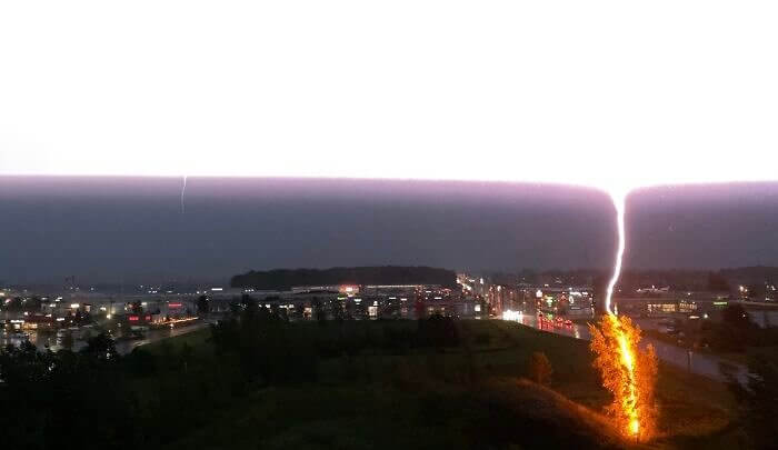
An Electric Storm Over Edmonton
Many people associate extreme weather with the southern and midwest areas of the United States, but what you might not realize is that these storms also reach further north. In fact, it's very common to witness storms in Canada - and this photo shows one taking place just over Edmonton. But as you can see, this isn't just any storm. From the lightning to the pink sky, this storm is as extreme as it gets.
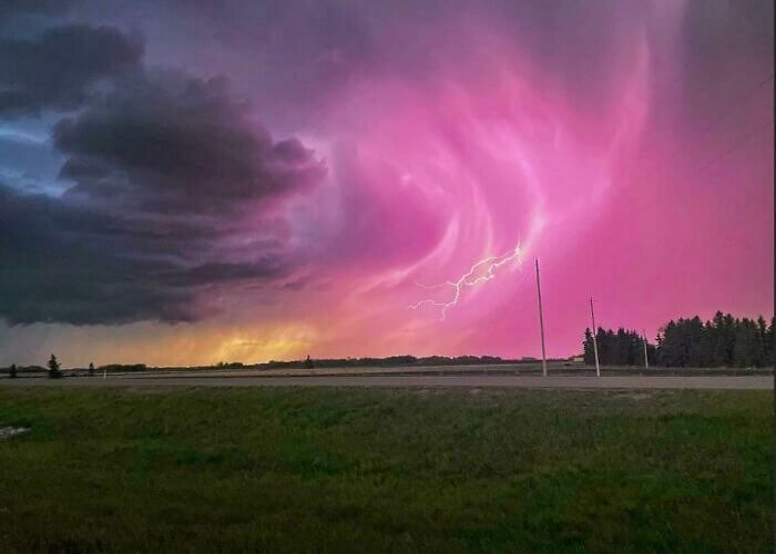
While this looks beautiful, the drastic color changes in the sky and that wall cloud forming nearby were sure signs that this storm was powerful and dangerous. So, let's hope everyone nearby was inside.
A Rainbow Lightning Storm
One thing you might not know about Hawaii is that these islands are constantly bombarded with extreme weather. This is especially true on the tourist island of Oahu, and this photo taken by Benji Barnes shows just how juxtaposing these extreme weather phenomena can be. On the one hand, you have a terrifying lightning strike that seems way too close to the buildings below. On the other hand, you have a typical Hawaiian rainbow.
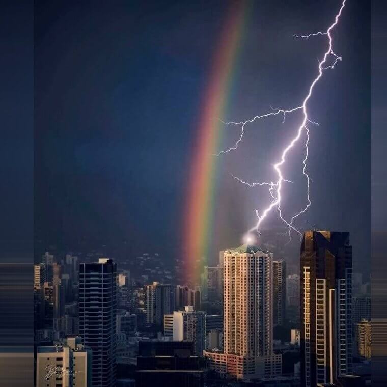
The fact that these two weather patterns can co-exist like that is both stunning and scary at the same time, but the rainbow is a sure sign that brighter moments are coming.
A Frozen Car After a Storm
Looking at this windscreen, it would be easy to assume that the glass is covered in frozen snakes. But the person who woke up to this strange phenomenon on their car confirmed that it was indeed just ice, formed after an intense bout of rain. But then, the rain froze quickly to around -1c and formed these strange shapes as a result. But why did that happen? And what caused the extreme weather?
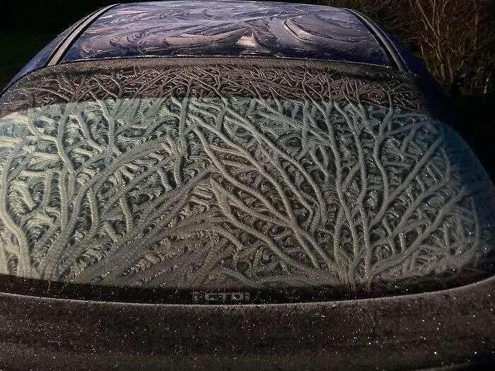
What's so scary about extreme weather phenomena is the fact that it often doesn't make sense. On this occasion, it's believed that the wind blew the rainwater and it then froze as it beaded, but it's still strange.
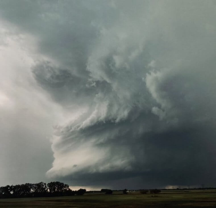
A Shelf Cloud in North Dakota
Looking at storm clouds from afar and from a picture can make them seem hauntingly beautiful, but shelf clouds like this one are extremely dangerous in real life. These low, horizontal cloud formations are a sure sign that a thunderstorm is about to touch down and wreak havoc on the houses and the land below, and this one certainly looks like a big and powerful one. Despite looking very beautiful at the same time.
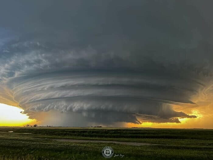
But it's the lighting behind this storm cloud that really makes it stand out from the crowd. It looks as though it's been sent from the gods, with a heavenly glow behind it.
A Collection of Sprites Over Oklahoma
Have you ever looked up into the sky and spotted bright lights that don't really make any sense? Well, you may have seen sprites. These lightning sprites are caused by electrical discharges in the Earth's mesosphere - which is found around 80km high in the sky. And while they're commonly associated with the formation of storm clouds, that doesn't mean that there has to be a storm on the horizon to see these things in the sky.
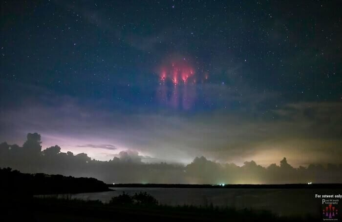
This photo, taken by Paul M Smith, shows these sprites in all of their glory, and there's no doubt about the fact that they're beautiful. However, they're also incredibly powerful.
A Lightning Storm in Bilbao
Lightning storms can happen anywhere in the world. They occur when the atmosphere is unstable and when the warm air is trapped under much colder air to the point where it creates static - and that's obviously what's happened here. This photo was taken in Bilbao, Spain, and what's so amazing about this weather phenomenon is that it was captured perfectly on camera. In real life, this probably looked like a quick flash of light.
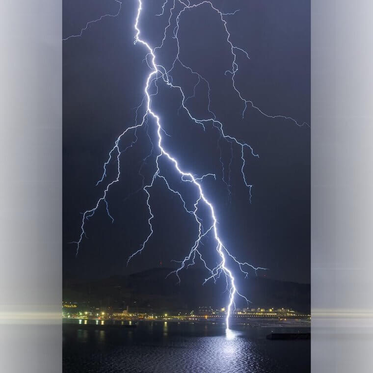
But this perfectly timed photo shows the strike of lightning in all of its glory, from its size and shape to the tendrils that are almost touching the water.
A Double Rainbow After a Storm
Seeing a rainbow is often associated with good luck, and there's no doubt about the fact that it can easily put a smile on people's faces. But there's nothing quite like seeing a double rainbow. And while most people assume that double rainbows are very rare, they're not as rare as you might think. That's because double rainbows are created when the sunlight is reflected twice within a raindrop, which happens very often.
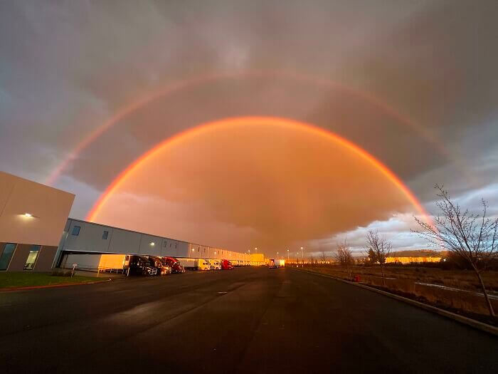
Despite how common they are, there's something about seeing a double rainbow that seems extremely heavenly. Perhaps it's the colorful auras that are often found around these stunning weather phenomena.
A Collection of Mammatus Clouds in Indiana
Normally, you can look up at the sky and see whether there's a storm brewing based on the clouds. In fact, clouds are a great indicator of an incoming storm, but what you might not realize is that clouds are also a great indicator that a storm has passed. This is the case with Mammatus clouds, which look like a large pile of rugs hanging out in the sky. Amazingly, these clouds only appear after a storm.
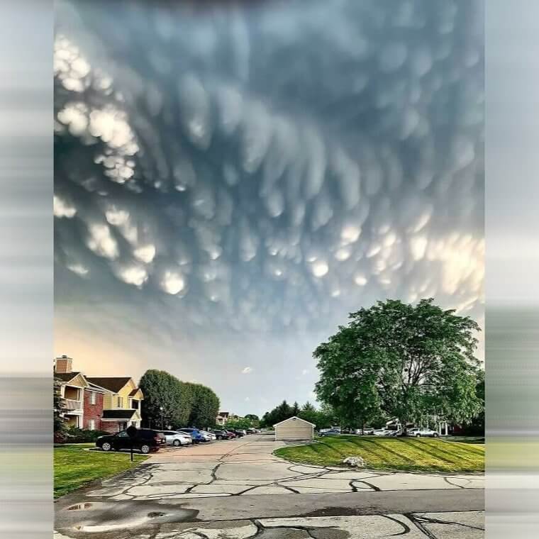
An hour before this photo was taken, this area of Indiana was hounded by a torrential downpour of hail and tornado supercell. But as the storm calmed down again, these beautiful clouds formed in its place.
A Collection of Lights in Sweden
If you have ever ventured over to any Scandinavian country, you'll know that their weather and meteorological patterns are stunningly beautiful. From the Northern Lights to the polar night, these countries are also covered in snow and ice - and this can result in some bizarre phenomena. And while this photo looks like it's showing some kind of alien landing site, this is actually the result of an extreme weather pattern.
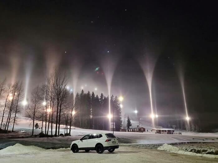
As there was so much water vapor in the air, it was causing the light to reflect and refract even more than usual. Ultimately, this made it seem as though the lights were being sucked into the air.
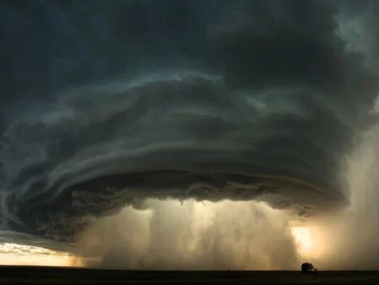
A 60,000-Foot Supercell
Supercells are some of the most extreme weather phenomenons you can see in the flesh. If you watch closely, you can see them spin and twist, forming a storm inside of them. But while this supercell looks beautiful in this picture, the person who took this photo saw it for the behemoth storm that it was. In fact, when the photographer made their way to the fields of Texas, they guessed that it was around 60,000 feet high.
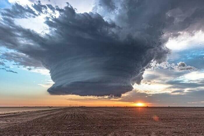
Shortly after this photo was taken, the area was then overwhelmed by a giant tornado and hailstorm that desecrated the fields below. Then, it was over almost as soon as it began.
A Twister in Wyoming
When you think of twisters, you might immediately think of flying cows and Hollywood storm chasers. But twisters are a very real threat to many areas of the United States, and this photo shows a twister setting down in Wyoming. And while the twister itself is an obvious sign of extreme weather, it's also important to note the weather patterns around the twister. Yes, just look at those storm clouds around it.
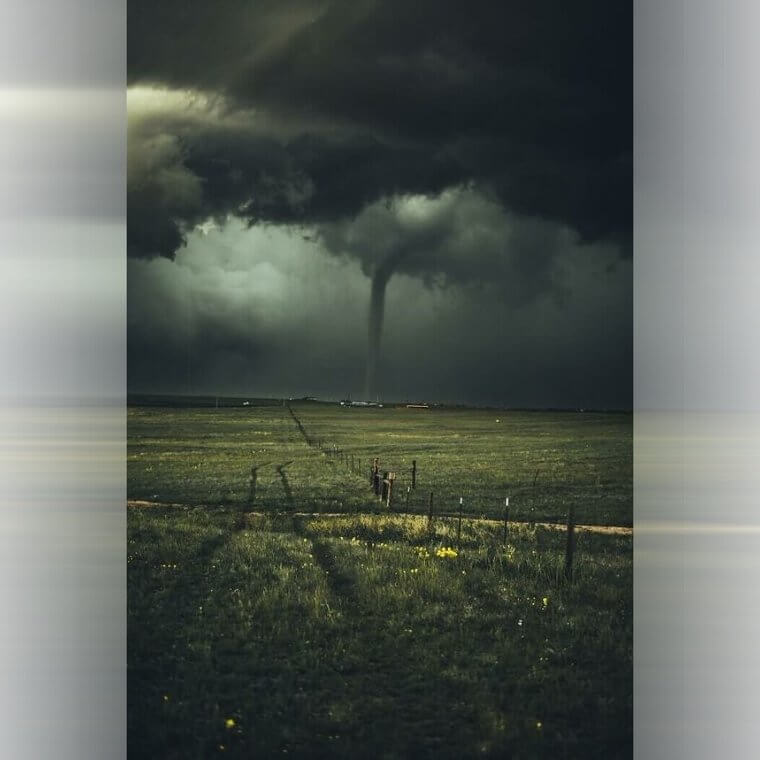
While the twister does the most damage when it touches ground, the storm clouds around the twister can also result in hailstones, high winds, and freezing cold temperatures. So, let's hope everyone over there was safe.
A Thunderstorm in Texas
While Texas is known for its warm weather and its many famous attractions, there's no denying the fact that this state is also known for its severe weather phenomenon. From extreme heat to extreme humidity and extreme storms, you never really know what you're going to get on a daily basis in Texas. Take this photo taken in New Braunfels, for example. On one side, you have clear blue skies.
On the other side, you have incoming storm clouds and giant bolts of lightning. On this occasion, it looks like the lightning strike missed the house below - but you can never be too sure unless you're there.
A Collection of Sunrays
Extreme weather phenomena can be scary and destructive, but sometimes they can also be beautiful and ethereal. Take this photo, for example. While this area of land was largely shrouded in clouds, a shining moment was when the sun peaked through the clouds to create these amazing sun rays. The fact that these rays were able to slice through the gaps in the clouds really is impressive, and something that should be appreciated.
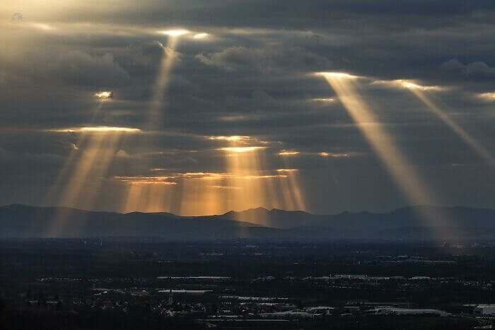
Of course, everyone has their own way of describing these rays. Some people call them "God's clouds," while others call them "flashlights from another world." Whatever the case, they're beautiful.
A Smoke-Filled Sky in Northern California
Mother Nature's weather conditions can't be controlled, but they can be changed and manipulated by other things going on in the world. And when these storm clouds formed in Northern California, they were changed by the nearby forest files that piled smoke into the sky. In fact, what resulted was a large collection of storm clouds that were painted in different colors - from orange to gray and even purple.
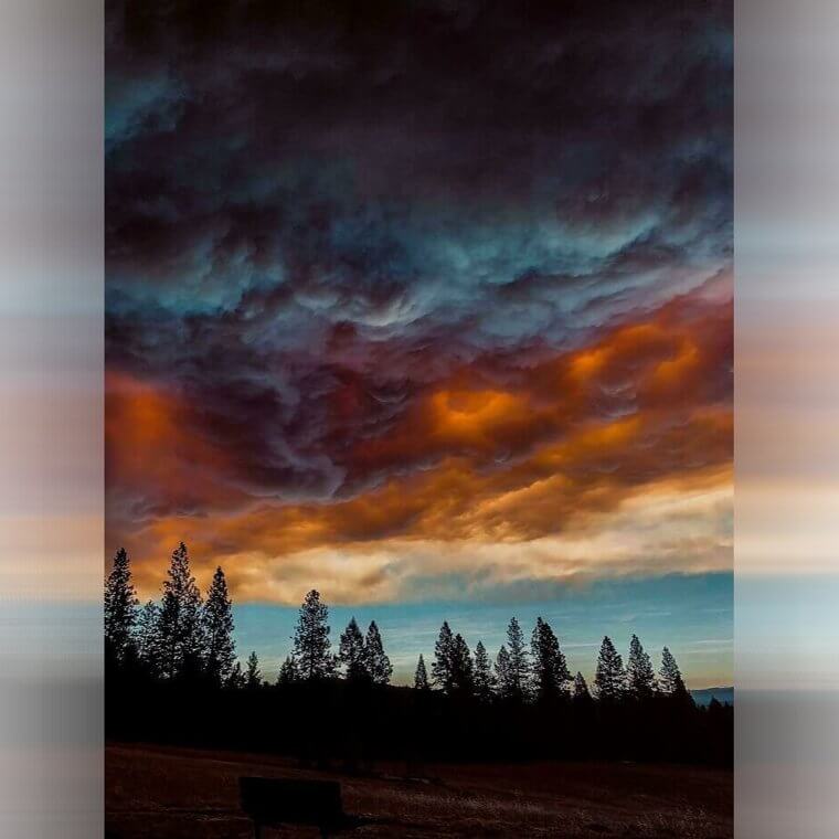
After devastating forest fires, looking up and seeing the sky seemingly on fire too must have been upsetting for those in the local area. Plus, we can't decide if this looks hauntingly beautiful or just completely terrifying.
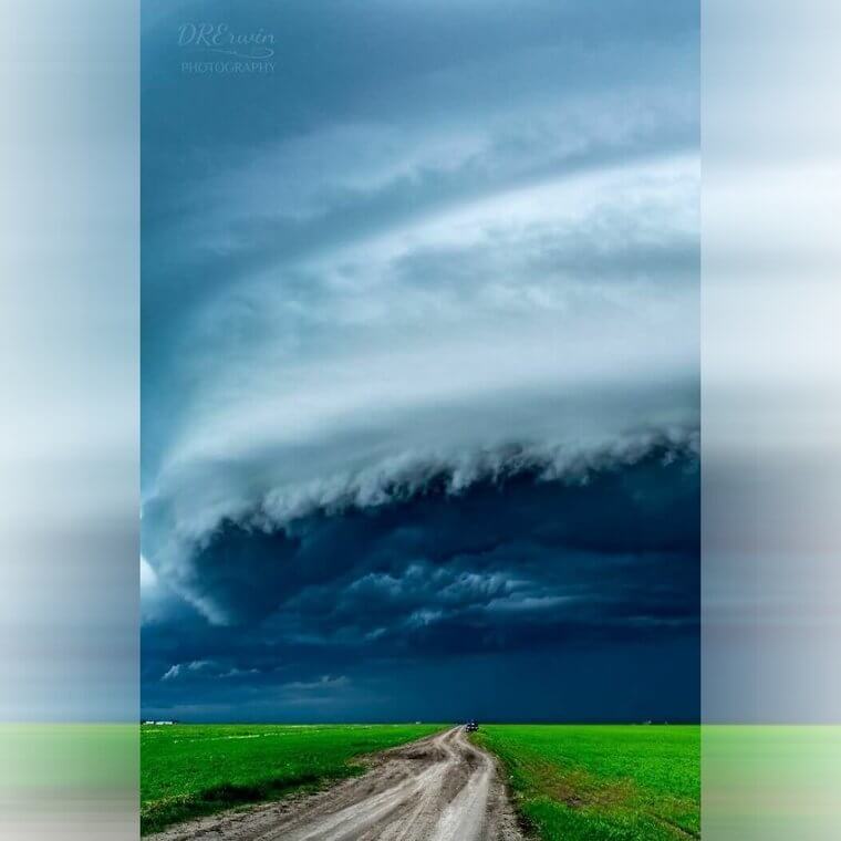
An Incoming Storm in South Dakota
While many people love the color green, there's no denying the fact that seeing green colors in the sky seems extremely ominous. It can make you feel uneasy, and it can make you feel scared of what's to come. However, that didn't stop Alex Resel from taking this photo in Sioux Falls in South Dakota. As soon as he spotted the incoming green storm, he knew he had to snap a picture.
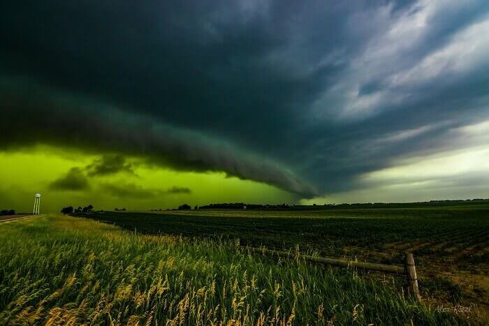
We're not sure which way that storm wall is going, but one thing we do know is that storm clouds like this normally result in high winds, cold temperatures, and a whole lot of hail.
A Double Rainbow Above the Fields
One of the most upsetting things about double rainbows is the fact that, normally, one of the rainbows is very strong and bright in appearance, but the second rainbow is normally very faint. This wasn't the case with this double rainbow, though. Both rainbows are as clear as day, and that's probably thanks to the dark storm clouds that surround it. But that's what makes them even more beautiful than we could imagine.
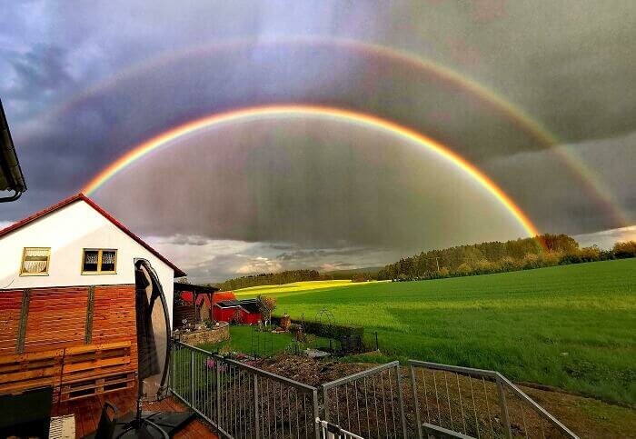
We don't blame this person for snapping this photo, either. If we looked out of our bedroom window and saw a double rainbow over the fields like this, we'd rush to get our phones, too.
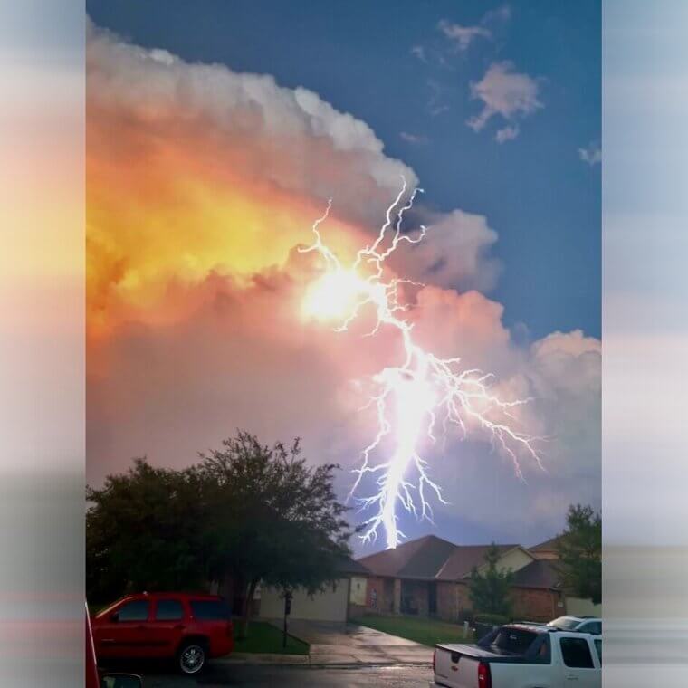
An Epic Lightning Storm in Florida
Anyone who has ever been to Florida will know that storms are very common. In fact, the theme parks constantly check the weather forecast for extreme weather warnings and often have to temporarily shut down their rides and rollercoasters when they learn of an incoming storm. But have you ever seen a lightning storm quite like this one before? Amazingly, we don't think we've ever seen lightning both above and below a cloud formation.
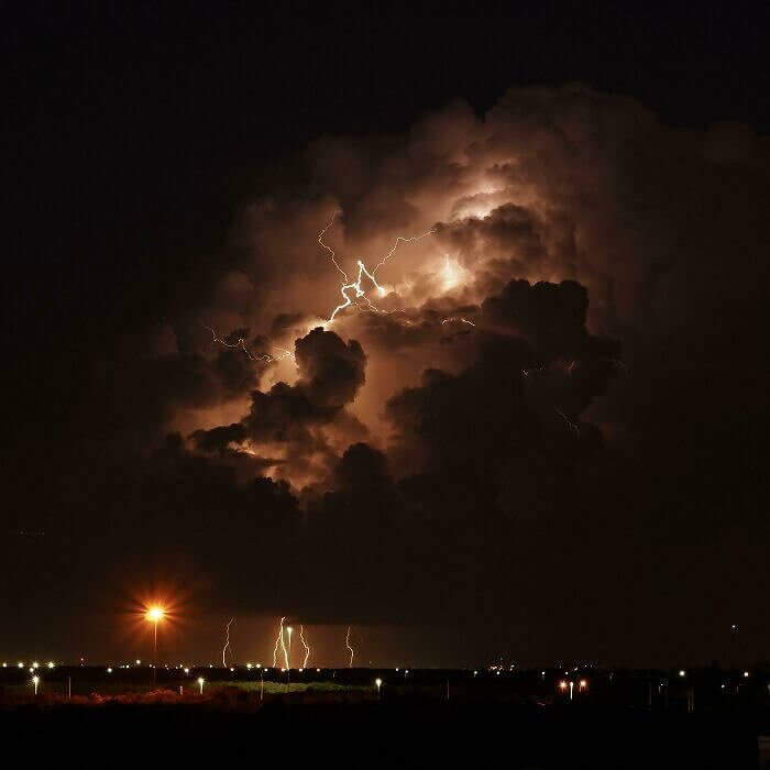
This probably happened because lightning bolts typically jump from cloud to cloud, and this even means that they can fly upwards! And on this occasion, it created the perfect mood lighting for such a weather phenomenon, too.
A Storm Over Oaklahoma
If you're looking at this photo and wondering whether it's real and not just a painting, we're here to confirm that this is a real photo. This stormchaser took this photo above Dover, OK, and it's one of the most stunning things we've ever seen. Of course, there's great power in great beauty - and this is certainly true when it comes to storm clouds like these ones.
What's so amazing about this extreme weather phenomenon is the fact that there are various different cloud formations merging into one area of the sky over there. And we bet that made for one intense storm.
A Supercell Thunderstorm in Montana
But while the people who live in Montana are used to seeing unusual cloud formations and tornado warnings on their phones, they also know that every storm is different and has its own unique quirks. And on this occasion, this supercell thunderstorm over the Montana prairie looked extra menacing, to say the least. Just look at the size of that thing and imagine being this close to it! We'd run for our lives.
This picture looks like there are multiple different tornado clouds bunched together into one giant cloud, and it covers a huge area. That means that there was absolutely nowhere to hide.
A Twisted Cloud Formation in Alberta
If you were driving along in your car and spotted this cloud formation in front of you, what would you do? Would you immediately turn around and drive in the opposite direction? Or would you keep driving? Well, cloud formations like this aren't too uncommon in places like Alberta, where mountains surround it. That's because these clouds are often formed by a warm downslope of wind coming down from the mountains.
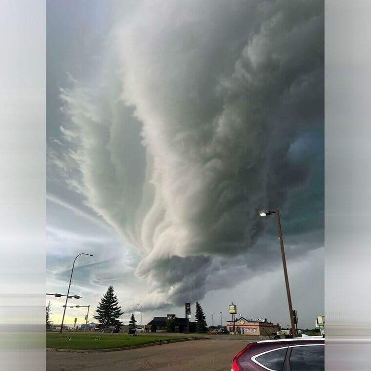
But there's no denying that the swirled stormy patterns and the twisting colors seem to suggest that something is amiss. Let's hope that it blew away before it affected this driver.
A Pastel-Colored Sky
While extreme weather phenomena can cause scary storms and result in tornado warnings, sometimes it can also have a positive effect on the world. Take this photo, for example. While the aquamarine water is enough to put a smile on your face and help you dream of a sunny vacation, the pastel colors in the sky are equally as beautiful. In fact, we can't even count how many colors there are in the sky.

This whole image is beautiful, but it's fair to say that these dream-like beach locations are also susceptible to high winds and thunderstorms. So, you still need to be on the lookout.
An Undulatus Asperatus in Turkey
Have you ever seen clouds like this? If you haven't, let us introduce you to Asperitas, or Undulatus Asperatus as it's otherwise known. This cloud formation is categorized by its wave-like features, and these normally appear in the base of the cloud itself. Yes, this picture taken in Turkey shows us exactly what these clouds look like, and there's no denying that they look like something out of a Van Gogh painting.
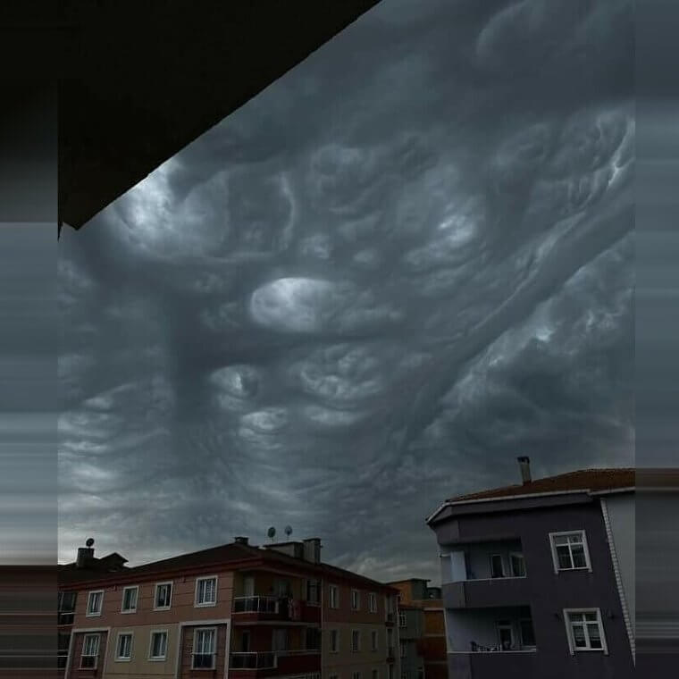
But what's so amazing about these clouds is that they rarely result in the formation of a storm. Instead, they just trick you into thinking that there's going to be a storm on the horizon.
A Sunbow in the UK
If you've ever been to the UK, you'll know that this country rarely experiences extreme weather. Most of the time, it's either rainy or relatively warm, without any major storms, floods, droughts, or other extreme weather. But many people in the UK have still experienced strange natural phenomena, like this person who managed to spot a sunbow in the sky above Plymouth. Although it's similar to a rainbow, a sunbow is an entity in itself.
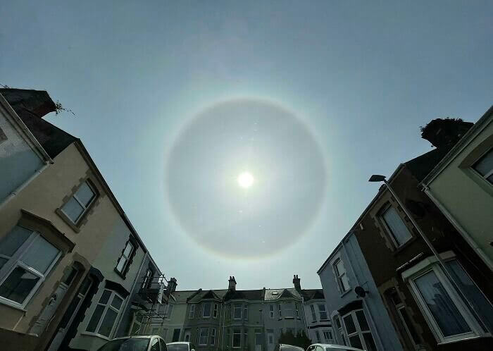
It's caused by the sunlight's refraction through a spray of water and typically forms like a halo around the sun. Of course, this makes it very difficult to look at and appreciate.
A Cloudy Sunrise in West Texas
If you're familiar with old wives' tales, you'll know that red sky can either be a good omen or a bad omen. If there's red sky at night, you have nothing to worry about. But if there's red sky in the morning, you should heed a warning. Unfortunately for this person, they took this photo in West Texas in the morning - and there's no doubt about the fact that these look like storm clouds, too.
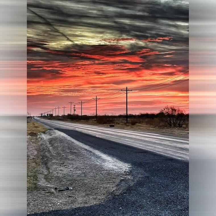
From the different colors to the general formation of these clouds, we bet this area of West Texas was battered with rain, high winds, and maybe even hailstones after this photo was taken.
A Storm Cloud Over the City
When you think of big supercells and immense storms, you probably think of these storms hitting remote areas of the country. from open fields to mountain ranges. And while this is often the case, that doesn't mean that storms can't also hit big cities - and this picture proves it. This image shows an immense storm gearing up to hit the city of Minneapolis, and it looks like it was a big one.
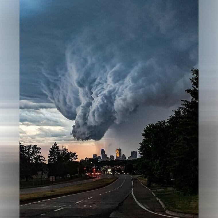
Luckily, being in a bit city means that the buildings offer people protection from the high winds and the rain, but there's no denying that being in high-rise buildings is risky in these conditions.
A Sunset Lightning Storm in Florida
Lightning storms can be terrifying, but people who live in Florida are used to seeing these flashes in the sky on a regular basis. In fact, some native Floridians would even say that this extreme weather is beautiful. While most people would disagree, there's no denying the fact that photos like this could sway us. This sunset lightning storm seems like its a gift from the gods thanks to the amazing colors and location.
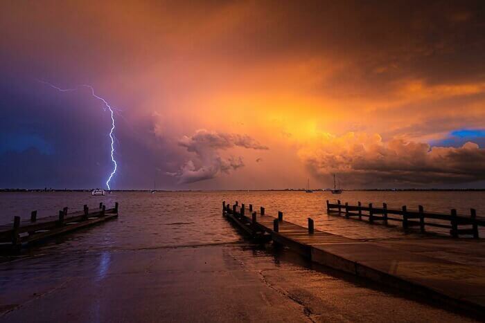
Of course, this is more of an ominous beauty than a stunning beauty. While it's attractive to look at, this storm can stick pack a real punch if you happen to be in the wrong place at the wrong time.
A Thunderstorm In Moose Jaw
In Moose Jaw, Saskatchewan, Canada, residents are used to getting extreme weather alerts on their phones, on their TVs, and their radios. This area of the planet is constantly beaten down by tornadoes, lightning storms, and strange weather phenomena that threaten livelihoods and the local area, and it's just something they have to live with. But while this photo is intense, it doesn't do these cloud formations any justice. In real life, they're much worse.
From the black skies to the swirling patterns of this cloud formation, you can see that this storm would have really packed a punch. In fact, it looks like it was probably more than thunderstorm.
A Lightning Bolt Striking a Tree
Lightning storms are extremely common, and most of the time, the lightning doesn't hit anything during these storms. But every so often, people and things are struck by lightning, and their lives are forever changed. Of course, it's hard to know what happens during this bout of extreme weather - but in this case, a photo can show us. Yes, this is the exact moment a lightning bolt hit a tree.
You can see just how powerful the lighting is, as it lights up the whole tree and falls from the sky. And we bet the tree wasn't the same again after that.
A Double Rainbow Lightning Strike
You know what they say: two is better than one. And it seems as though that is the case with Mother Nature. But getting two of the same thing at the same time is very rare - which is why this photo is so unbelievable. This shows extreme weather and natural weather phenomenons in all of their beauty, as there are not just two rainbows - there are also two bolts of lightning striking at the same time.
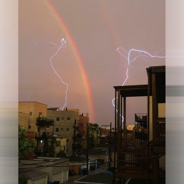
This phenomenon has probably only happened a handful of times over the course of history, which makes this photo even more impressive. We bet there aren't many like it around.
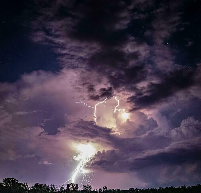
A Nighttime Lightning Strike
Extreme weather can come in so many shapes and sizes, and it's important to realize that lightning storms also come in so many different shapes and sizes. Sometimes, you'll just have a single bolt of lightning. Other times, the storm will take place during the day. Then, on occasions, you may even find that the lightning storm takes place at night with a whole host of lightning bolts that create one perfect storm.
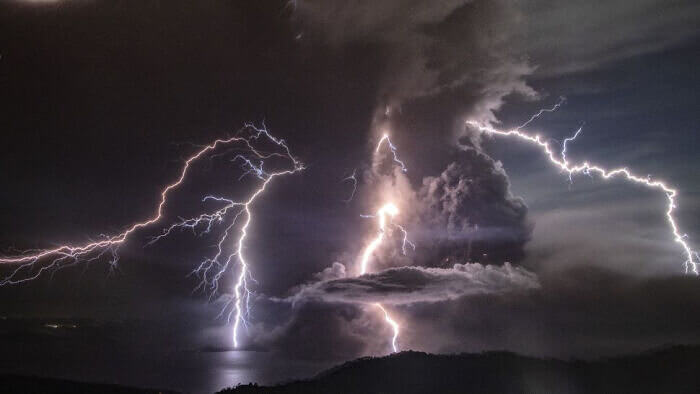
This is a prime example of that. And if you looked up into the sky and saw this playing out in front of you, there's a high chance that you'd be pretty scared.
A Collection of Altocumulus Clouds
There are over 100 types of clouds that we know of so far, but one of the most stunning types is the Altocumulus. This cloud formation can be seen in the picture below, which was taken in the beautiful historic city of Oxford in England. Categorized by the patches of clouds, also called cloudlets, skies like this can remind many people of cotton candy. So, they're often called 'cotton candy clouds.'
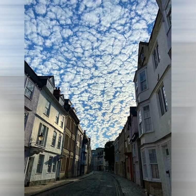
Thankfully, these clouds don't hint at any extreme weather on the horizon. They're not storm clouds but are harmless cloudlets that put a smile on the faces of those who walk underneath them.
A Shelf Cloud Taking Over the Sky
At first glance, you may have assumed that this industrial area was covered in a white sheet or cover of some sort. After all, it doesn't look like the sky at all! But in reality, this is the result of an intriguing cloud formation called a cloud shelf. It's formed when the humidity inside of the cloud makes it denser than the air outside of the cloud. So, it creates its own little bubble.
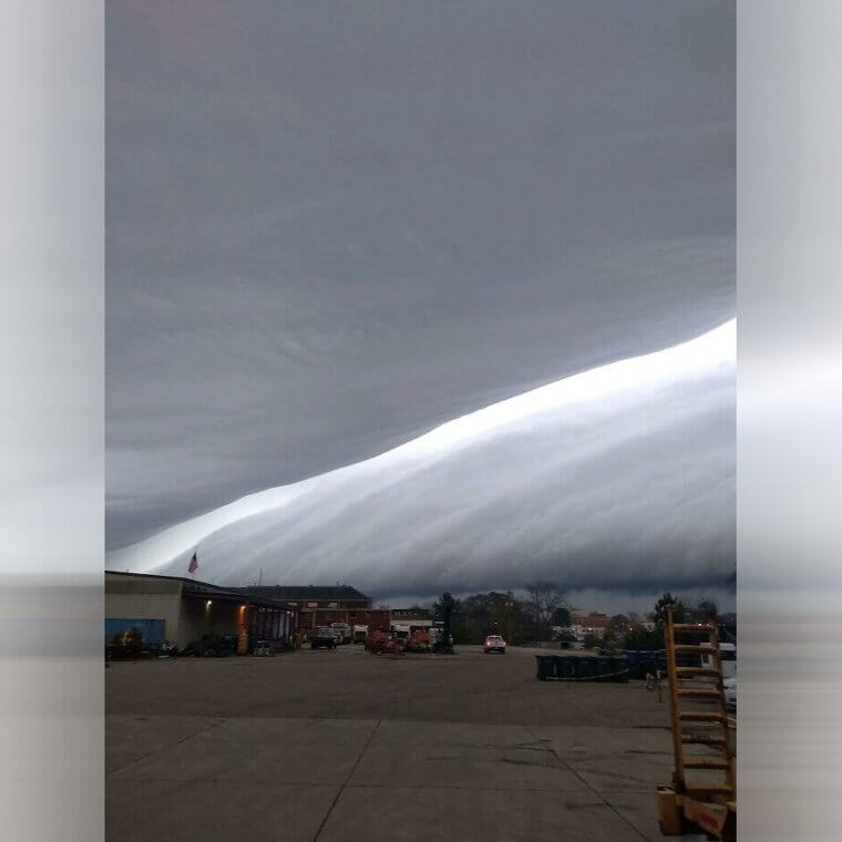
The end result is a cloud formation that seems to create a shelf over the world below it, and we bet it probably feels quite unusual for those who suffer from claustrophobia.
A Twister in Nebraska
To some people, seeing extreme weather and rare weather phenomena in the wild isn't something they have on their to-do list. But then there are storm chasers who live for following these extreme weather patterns and taking photos of these strange phenomena. Take this person, for example. They made their way out into the empty landscape of Nebraska to find a twister, and luckily for them, that's exactly what they did.
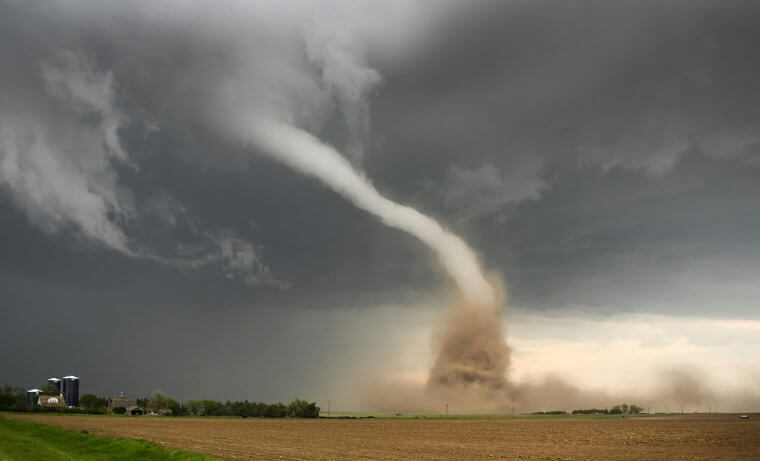
This photo shows the true power and unpredictability of a tornado. It twists, it turns, and sometimes it lands where you don't expect it to land. So, you need to be careful.
A Passing Storm in Virginia
Having a knowledge of clouds and storms can really help you out if you live somewhere that's prone to extreme weather. You can determine one cloud from the next and work out whether you need to protect yourself from an oncoming storm. Thankfully, the person who took this photo is knowledgeable when it comes to these weather patterns, and they were able to determine that this was the backside of a storm - rather than the beginning.
This photo was taken in Powhatan, Virginia, and there's no denying the fact that it's a beautiful photo. But there's also no denying that this person timed their photography efforts perfectly.